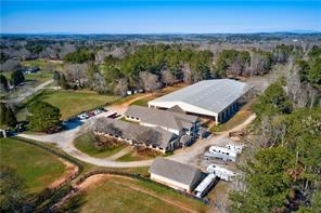
Property Record
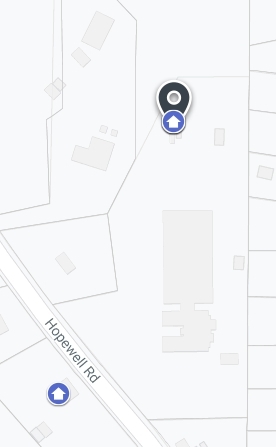
13835 Hopewell Rd, Alpharetta, GA 30004
NEARBY LISTINGS FOR SALE OR LEASE
Property Detail
13835 Hopewell Rd
22-4760-0820-070-7
2022 NEW CUVA 1 COVENANT 2 PARCELS SEE TIEBACK CONSOLIDATION FROM 064-0, 065-7 AND 0837-036-9
Agriculturalland
Fulton
X
Georgia
13121C0056G
837
2023
17.69 AC
2023
N Fulton/Forsyth County
011661
Atlanta
2,880 SF
Atlanta-Sandy Springs-Roswell, GA
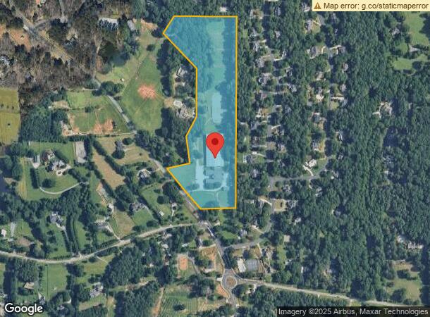
DEMOGRAPHICS near 13835 Hopewell Rd
1 Mile
3 Mile
5 Mile
2024 Total Population
1,643
46,155
114,277
2029 Population
1,681
48,139
120,816
Pop Growth 2024-2029
+ 2.31%
+ 4.30%
+ 5.72%
Average Age
40
38
38
2024 Total Households
518
16,403
41,591
HH Growth 2024-2029
+ 2.32%
+ 4.02%
+ 5.66%
Median Household Inc
$195,689
$134,171
$135,637
Avg Household Size
3.10
2.70
2.70
2024 Avg HH Vehicles
3.00
2.00
2.00
Median Home Value
$734,738
$541,876
$521,820
Median Year Built
1993
1997
1998
Nearby Places
- Restaurants
- Banks
- Shops
- Fitness
- Groceries
SALE & LEASE HISTORY
LISTING DATE
SALE/LEASE

Oct 08, 2018
For Sale
Feb 25, 2020
For Sale
Nearby Properties
Address
Land Use
TOTAL SIZE
Lot Size
Zoning
Address
Land Use
TOTAL SIZE
Lot Size
Zoning
574,271 SF
45.82 AC
AC
Address
Land Use
TOTAL SIZE
Lot Size
Zoning
461,754 SF
28.07 AC
C1C
Address
Land Use
TOTAL SIZE
Lot Size
Zoning
645,668 SF
30.05 AC
AC
Address
Land Use
TOTAL SIZE
Lot Size
Zoning
440,698 SF
25.68 AC
R4
Address
Land Use
TOTAL SIZE
Lot Size
Zoning
550,076 SF
45.25 AC
OIC
Address
Land Use
TOTAL SIZE
Lot Size
Zoning
294,122 SF
11.80 AC
R4
Address
Land Use
TOTAL SIZE
Lot Size
Zoning
56,313 SF
13.37 AC
MP
Address
Land Use
TOTAL SIZE
Lot Size
Zoning
2,289 SF
84.27 AC
AG1
Address
Land Use
TOTAL SIZE
Lot Size
Zoning
286,394 SF
39.10 AC
R1
Address
Land Use
TOTAL SIZE
Lot Size
Zoning
216,794 SF
6.66 AC
OI
Address
Land Use
TOTAL SIZE
Lot Size
Zoning
90,671 SF
11.03 AC
MP
Address
Land Use
TOTAL SIZE
Lot Size
Zoning
506,411 SF
59.74 AC
OI
Address
Land Use
TOTAL SIZE
Lot Size
Zoning
373,746 SF
19.89 AC
TRCON
Address
Land Use
TOTAL SIZE
Lot Size
Zoning
186,907 SF
13.93 AC
A0
Address
Land Use
TOTAL SIZE
Lot Size
Zoning
279,125 SF
18.55 AC
OI
Address
Land Use
TOTAL SIZE
Lot Size
Zoning
240,226 SF
39 AC
OI
Address
Land Use
TOTAL SIZE
Lot Size
Zoning
396,000 SF
43.42 AC
C1
Address
Land Use
TOTAL SIZE
Lot Size
Zoning
241,675 SF
8.30 AC
CUP
Address
Land Use
TOTAL SIZE
Lot Size
Zoning
64.48 AC
AG1
Address
Land Use
TOTAL SIZE
Lot Size
Zoning
137,848 SF
8.37 AC
OIC
Address
Land Use
TOTAL SIZE
Lot Size
Zoning
22.48 AC
OI
Address
Land Use
TOTAL SIZE
Lot Size
Zoning
137,848 SF
9.51 AC
OIC
Address
Land Use
TOTAL SIZE
Lot Size
Zoning
1,175 SF
40.66 AC
AG1
Address
Land Use
TOTAL SIZE
Lot Size
Zoning
1,144 SF
35 AC
AG1
Address
Land Use
TOTAL SIZE
Lot Size
Zoning
103,825 SF
14.46 AC
C1
Address
Land Use
TOTAL SIZE
Lot Size
Zoning
202,466 SF
22.85 AC
C1C
Address
Land Use
TOTAL SIZE
Lot Size
Zoning
125,181 SF
10.95 AC
C2
Address
Land Use
TOTAL SIZE
Lot Size
Zoning
37.61 AC
AG1
Address
Land Use
TOTAL SIZE
Lot Size
Zoning
182,470 SF
14.24 AC
C1
Address
Land Use
TOTAL SIZE
Lot Size
Zoning
6.07 AC
MP
The World's #1 Commercial Real Estate Marketplace
Connect with us
© 2025 CoStar Group
The information above has been obtained from sources believed reliable. While we do not doubt its accuracy we have not verified it and make no guarantee, warranty or representation about it. It is your responsibility to independently confirm its accuracy and completeness. Any projections, opinions, assumptions, or estimates used are for example only and do not represent the current or future performance of the property. The value of this transaction to you depends on tax and other factors which should be evaluated by your tax, financial, and legal advisors. You and your advisors should conduct a careful, independent investigation of the property to determine to your satisfaction the suitability of the property for your needs.